

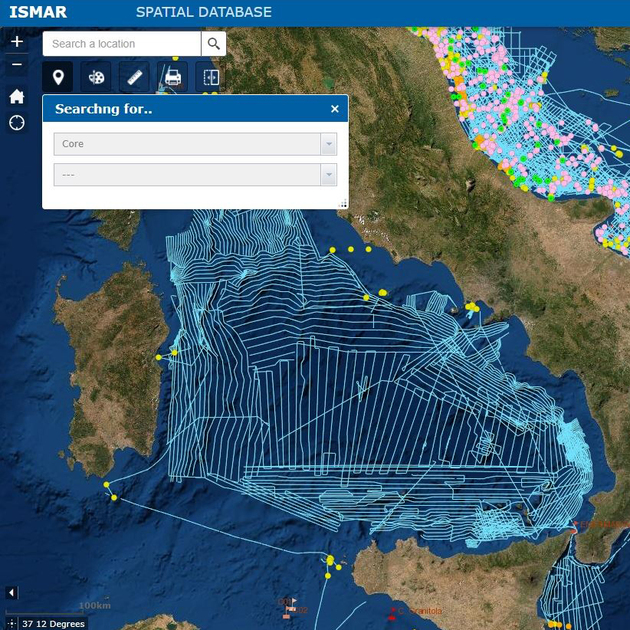
The Seamap Explorer is an advanced platform for marine spatial data, integrating decades of data collected by ISMAR and ISP from across the globe. Users can navigate interactive maps and explore visualized elements such as survey areas, seismic profiles, and seabed and water column sampling points. Research outputs, including detailed cartography, are also accessible.
Seamap Explorer is a web-based cartographic viewer developed as part of a spatial data infrastructure (SDI) by the ISMAR Bologna branch. This infrastructure has been designed over the years to meet various project and operational needs. It includes:
- A relational spatial database aligned with data models from the INSPIRE Directive.
- A metadata catalog that makes the data searchable and, where applicable, accessible and reusable.
- Cloud storage for efficient data management and flow.
Key Features:
- Centralized information management: Access all data in one place.
- Searchable metadata catalog: Quickly locate the layers and datasets you need.
- Downloadable cartographic data: Available when permitted.
- Dynamic updates: Seamlessly distributed through real-time links to the database via OGC services (WMS, WFS, WCS).
- Wide accessibility: Reachable from anywhere, with no special software required.
- Real-time interaction: Explore and analyze data in the moment.
User adaptability: Tailored for different user types, from researchers to professionals
Contacts:
The Seamap Catalog is an organized repository of geospatial resources, services, maps, and non-geographic datasets produced by ISMAR and ISP. It provides detailed metadata to facilitate access to:
- Available data and products.
- Access and usage methods.
- Limitations on usability.
- Data history and points of contact.
Powered by metadata, the catalog allows users to search for information using OGC – CSW (Catalogue Web Service), review metadata, and download or request access to datasets based on the data owner’s policies.
Developed at the ISMAR Bologna branch using GeoNetwork open-source software, the Seamap Catalog is part of a broader spatial data infrastructure (SDI) that includes:
- A relational spatial database inspired by the INSPIRE Directive.
- A geoportal integrating digital resources described in the catalog.
- Cloud storage for efficient data management.
Key Features
- Discover and Access: Quickly locate and retrieve datasets.
- Publish and Manage: Organize and share metadata effectively.
- Streamline Resources: Maintain datasets efficiently.
Contacts:
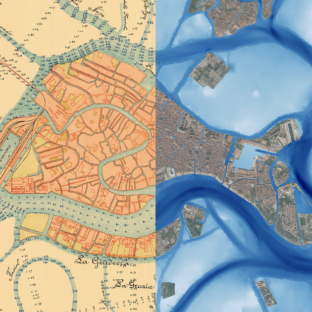
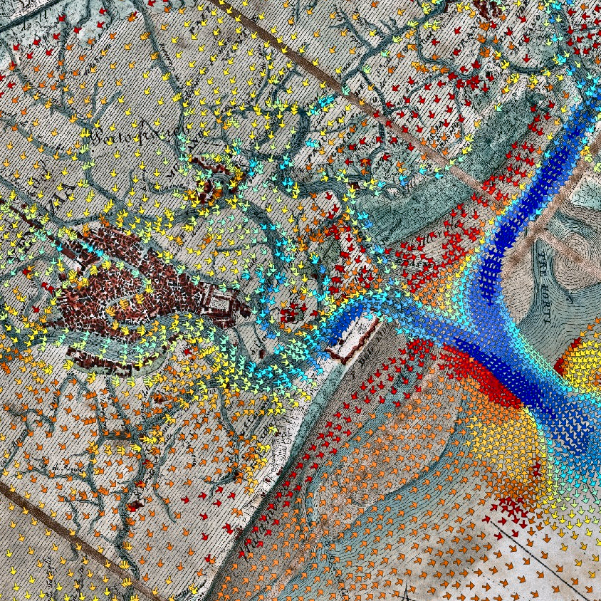
CIGNo (Collaborative Interoperable Geographic Node) is a pioneering platform for sharing geospatial data and maps, developed by CNR-ISMAR in collaboration with CORILA. Launched in 2002, it led to the development of the Atlas of the Venice Lagoon, a dynamic resource offering detailed insights into the lagoon’s environment, its watershed, and the adjacent coastal zone.
The CIGNo portal transforms data into actionable insights, providing users with tools like Map Swipe to compare historical and modern maps or overlay observational campaigns from the same area. It’s a resource for researchers, policymakers, and the general public alike, bridging the gap between data and understanding.
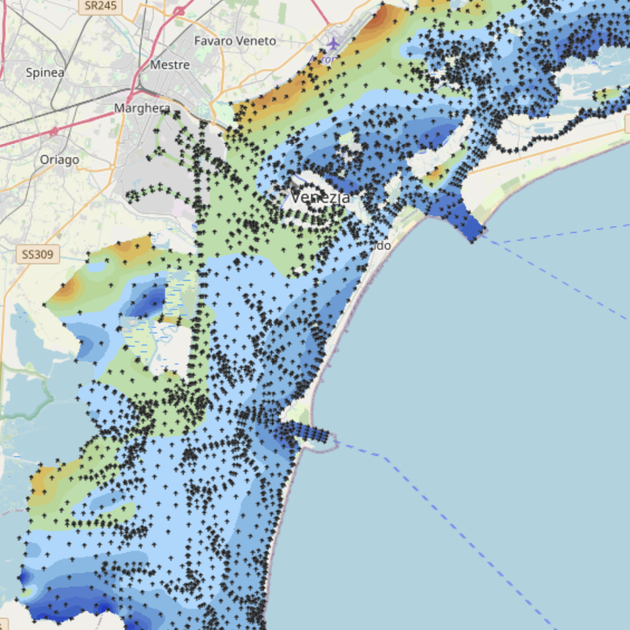
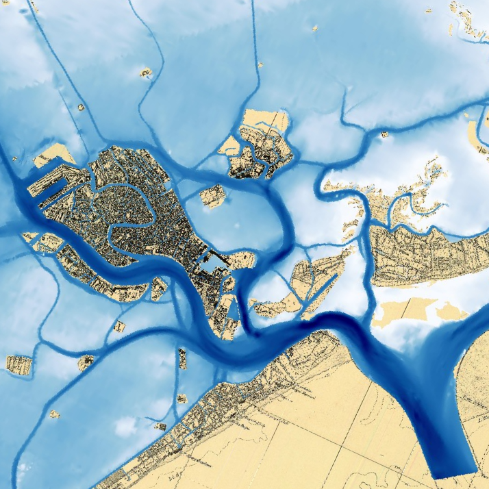
The Atlas of the Venice Lagoon is an extensive collection of interactive maps complemented by texts, tables, illustrations, and external databases. It provides a detailed exploration of various aspects of the lagoon’s environment, its surrounding territories, and Venice’s coastal zones. This portal is the result of collaboration among numerous public entities, including ISMAR-CNR.
Purpose
The atlas serves as a web portal offering environmental geographic data about the Venice Lagoon. It is developed with contributions from multiple public institutions to ensure comprehensive data integration.
Geographic Area
Although the Venice Lagoon is the primary focus, the atlas also incorporates environmental data from its drainage basin and adjacent coastal waters.
Target Audience
The atlas is designed to consolidate and organize data from diverse sources, ensuring that a broad range of users—including citizens, professionals, and institutions—can access a unified information database.
Included Data (General Categories)
The atlas currently hosts approximately 200 datasets, with regular updates, particularly through WMS protocols. These datasets fall into several categories:
- Base Maps: Key morphological features, aerial imagery from various years, and national and regional topographic maps.
- Biosphere: Lagoon habitats, coastal vegetation, seagrass distribution in the Venice Lagoon, fish farming areas, ecological studies of small islands, and the spread of invasive macroalgae.
- Atmospheric Climate: Air temperature, precipitation, and wind maps for the lagoon and its drainage basin.
- Hydrosphere: Tides, waves, and temperature and salinity models of the Venice Lagoon.
- Lithosphere: Historical and contemporary lagoon depth measurements, sedimentology, and more.
- Protected Areas: Natura 2000 sites, Ramsar wetlands, Important Bird Areas (IBAs), and navigation speed limit zones.
- Anthroposphere: Nature and historic trails, historical military fortifications, public transportation routes within the lagoon, and pollutant emissions data from industrial facilities (based on the European Environment Agency’s PRTR database).
- Special Projects: Georeferenced photographs taken by astronauts aboard the International Space Station, maps of biogenic barriers off the Venice coast, and studies on the morphological evolution of the lagoon.
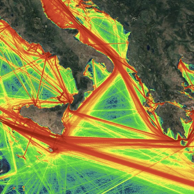
Tools4MSP
The Tools4MSP Geoplatform is an innovative, collaborative web-based tool designed to transform how we understand and manage coastal and marine environments. By integrating diverse data sources and advanced geospatial tools, it supports Maritime Spatial Planning (MSP) processes and promotes sustainable development strategies for our seas.
Key Objectives
The Tools4MSP Geoplatform empowers users with:
- Data Integration: Bringing together and organizing valuable datasets and metadata critical for effective MSP implementation.
- Open Access: Allowing users to explore, access, and reuse geospatial data freely.
- Interactive Storytelling: Enabling the creation of compelling content like interactive maps, dashboards, and geostories to support informed decision-making and sustainability goals.
- Advanced Tools: Providing cutting-edge geospatial analysis tools to assess cumulative impacts, analyze maritime use conflicts, and evaluate threats to marine ecosystem services.
- Sustainability Focus: Promoting open-source solutions to ensure accessibility and collaboration.
- Interoperability: Leveraging open standards (e.g., OGC services) to seamlessly connect with external projects and share data across diverse stakeholder groups.
Geographic Scope
The Geoplatform is primarily used in the Adriatic-Ionian and Mediterranean regions, though its functionalities can be applied to other marine areas.
Contacts:
A Platform Built on Collaboration
The Tools4MSP Geoplatform is the result of years of collaboration, evolving through a series of groundbreaking projects:
- ADRIPLAN (2013–2015).
- RITMARE Flagship Project (2016–2018)
- SUPREME (2017–2018)
- Pharos4MPA (2018–2019)
- PORTODIMARE (2018–2020)
- Ongoing Innovations: The platform continues to evolve through projects like AZA-Sardegna (2020–2023), BRIDGE-BS (2021–2025), MSP4BIO (2022–2025), and ReMAP (2022–2025).
ISMAR’s Contribution to Copernicus Marine Service
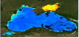
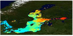
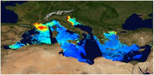
The Ocean Colour Thematic Assembly Centre (OCTAC), with the Rome branch of ISMAR leading a key work package, provides daily marine data, including ocean color and satellite-derived sea surface temperature (SST). Additionally, the Global Ocean Satellite monitoring and marine ecosystem study group (GOS) contributes observations of plankton, SST, and Multi-Observation TAC (MOBTAC) data, such as emergent radiance and optical properties, for the Baltic, Black, and Mediterranean Seas.
The GOS group at the Naples and Rome branches of ISMAR is instrumental in implementing an integrated observational system. This system supplies critical data for understanding physical and biogeochemical ocean processes, catering to the needs of institutional users, national and regional services, and the general public.
ISMAR is deeply involved in the European Commission’s Copernicus Marine Environment Monitoring System (CMEMS), contributing in several capacities:
- Prime contractor for:
- Ocean Colour Thematic Assembly Centre (OCTAC)
- Sea Surface Temperature Thematic Assembly Centre (SSTTAC)
- Dissemination Unit (DS) for the entire CMEMS.
- Partner in:
- Multi-Observation Thematic Assembly Centre (MOBTAC)
- Copernicus Climate Change Service (C3S).
ISMAR’s work underpins key Copernicus services, delivering essential oceanographic data that support a diverse user base. These contributions enable effective monitoring of marine ecosystems, improving understanding of physical and biogeochemical processes while informing decision-making at both regional and global scales.
Regional and Global Satellite Products
ISMAR provides high-quality satellite-derived data for the following marine areas:
- Baltic Sea
- Black Sea
- Mediterranean Sea
- Global Ocean
Contact
For more information, reach out to:
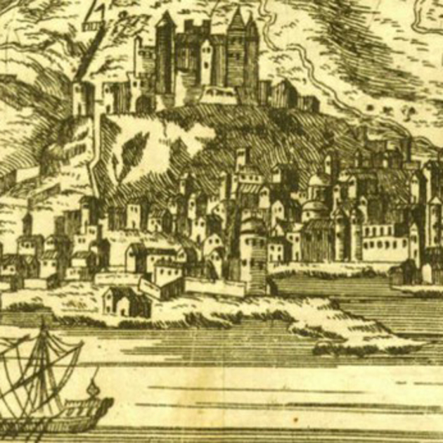
The Adriatic Studies Archive (ASA) is ISMAR’s repository for books, maps, documents, and scientific collections dedicated to the Venice Lagoon, the Adriatic Sea, and marine studies in general. Located at the historic Canonica complex in Venice, ASA provides an open-access digital archive that preserves the rich historical heritage of research institutions based at this site since 1932.
The collection traces its origins to the Royal Italian Thalassographic Committee, followed by the Institute of Adriatic Studies, the Maritime Fisheries Observatory, the Institute of Marine Biology, and the Institute for the Study of the Dynamics of Large Masses. These institutes were consolidated in 2003 into the Institute of Marine Sciences (ISMAR), which now has its main headquarters at the Arsenale of Venice.
Continuously expanding through collaboration with IRCrES CNR in Turin, the ASA also includes the Algarium Veneticum, an algological herbarium originating from collections made between 1941 and 1950 by Michelangelo Minio, Nicolò Spada, and Giacomo Zolezzi. This collection has since been enhanced with new samples for studying marine biodiversity and transitional environments.
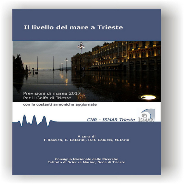
Tide Forecast Bulletin for Trieste
The ISMAR Trieste branch annually produces astronomical tide forecasts for the Port of Trieste, as part of its scientific collaboration with the Alpine-Adriatic Meteorological Society (SMA-A). These forecasts are available for download at the link below:
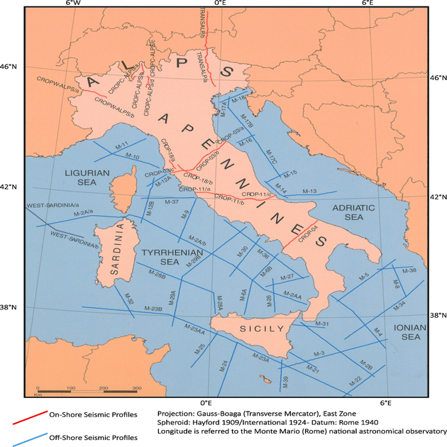
CROP Database
The CROP (Deep Crust) project is Italy’s geophysical research program using multichannel seismic reflection methods to achieve key objectives:
- Understanding the geodynamic processes shaping Italy’s current geological configuration.
- Defining and mitigating geological risks.
- Exploring energy resources, including hydrocarbons and geothermal energy.
The project was a collaborative effort between CNR, ENI, and ENEL, co-financed through two agreements between 1989 and 1999. These efforts resulted in the acquisition, processing, and interpretation of approximately 10,000 km of multichannel seismic reflection lines, both onshore and offshore.
Purpose of the CROP Database
The CROP Database ensures the long-term preservation and accessibility of seismic data while maintaining confidentiality. Its goals include:
- Protecting magnetic tapes and paper documentation from accidental damage.
- Ensuring data readability over time.
- Managing data dissemination in compliance with established regulations.
Since 2001, following a public tender, CNR-ISMAR Bologna has managed the CROP Database, focusing on:
- Recovering and cataloging paper documentation from the project.
- Standardizing and archiving positional data.
- Restoring and cataloging magnetic tapes containing original digital data.
- Converting magnetic data to modern storage formats and archiving it on disk spaces with NAS-backed periodic backups.
- Developing a web portal to access metadata and facilitate the distribution of digital data for academic and industrial use.
For More Information
To learn more about the data, usage policies, or to make requests, visit:
Or contact: