
Cartography
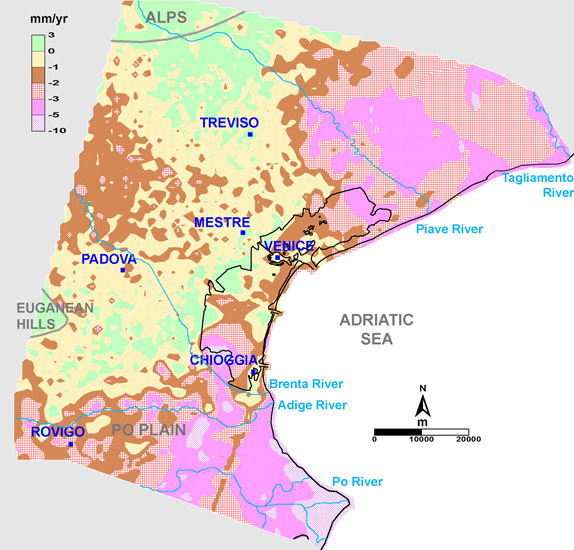
Map of Regional Soil Movements (Subsidence and Uplift) 1992-2002
For the first time, a comprehensive map was created to illustrate the speeds of regional soil movements across the entire Venetian coastal plain for the period from 1992 to 2002. This map revealed unexpected spatial variability in ground movements at both regional and local scales, highlighting annual changes ranging from a few millimeters of uplift to several centimeters of subsidence. The regional-scale analysis was conducted using the Integrated Subsidence Monitoring System (SIMS), which combines high-resolution Synthetic Aperture Radar (SAR) interferometric measurements with the precision of traditional leveling and differential continuous GPS measurements.
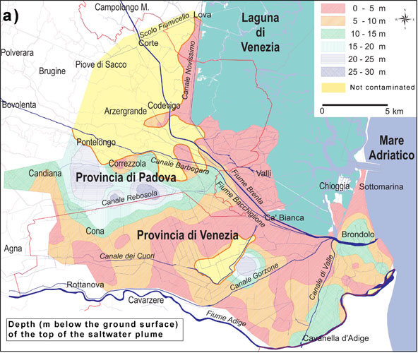
Saline Contamination in Coastal Areas
An Example from the Venetian Coast
The accompanying images depict the depth of the fresh-salty water interface along the Venetian coast. Areas classified within the first depth class (0-5 meters) are at high risk of soil desertification, as salt contamination exerts a direct negative impact on agricultural land.
Saline contamination can extend up to 20 km from the coast, a phenomenon exacerbated by various factors, including the presence of buried geomorphological structures (such as paleochannels), subsidence of land relative to average sea level—reaching up to 4 meters—and the rising tide along river estuaries.
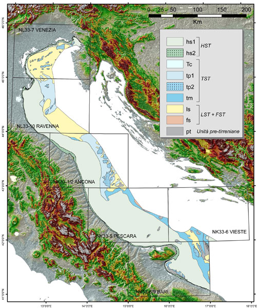
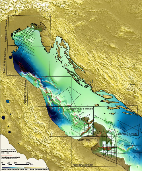
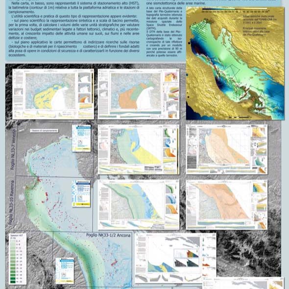
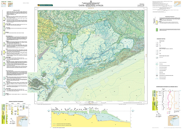
CARG Project (Geological Cartography)
ISMAR has a long-standing commitment to marine geological cartography and thematic cartography focused on identifying seabed characteristics and assessing environmental risks in Mediterranean marine areas. Our dedicated working group has developed the Geological Maps of Italian Seas at a scale of 1:250,000 in collaboration with ISPRA (Institute for Environmental Protection and Research), the Geological Service of Italy.
These geological maps cover the Adriatic basin and include several key sheets, which are:
Venice (NL-33-7)
Ravenna (NL-33-10)
Ancona (NK33-1/2)
Pescara (NK33-5)
Vieste (NK33-6)
Bari (NK33-8/9)
Each map sheet comprises an Illustrative Note accompanied by two primary cards: one depicting surface geology and the other illustrating the characteristics of the seabed. This comprehensive approach enables detailed analysis of geological features and environmental conditions in the region.