

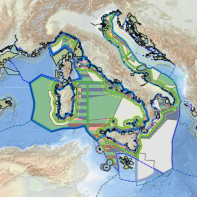
The Tools4MSP Geoplatform is a collaborative web-based tool for the co-production, management, and sharing of information resources and scientific knowledge related to coastal and marine areas, with the aim, in particular, of supporting Maritime Spatial Planning
Interoperable Data Management and Maritime Spatial Planning
Maritime Spatial Planning (MSP) is essential for the efficient, safe, and sustainable use of our seas and oceans. It aims to foster harmonious development across both traditional and emerging economic sectors—such as renewable marine energy—while protecting the environment by reducing human impacts and establishing new protected areas. MSP also promotes the restoration of degraded ecosystems and habitats and encourages cross-border cooperation for sustainable ocean management.
The European Union has established a Framework Directive (No. 89/2014) that supports all major maritime policy initiatives, including the Strategy for a Sustainable Blue Economy. Since 2013, CNR-ISMAR has played a key role in this process by participating in numerous national and European research projects. The institute collaborates with other CNR Institutes, national and international academic and research organizations, and engages with a wide community involved in MSP efforts. Since 2020, ISMAR has also supported the National Competent Authority on MSP (the Ministry of Sustainable Infrastructures and Mobility) in preparing the necessary plans required by the EU Directive.
To enable effective decision-making and planning, ISMAR promotes the sharing of scientific and non-scientific information regarding the environment, maritime activities, and current trends. The institute is dedicated to creating open and interoperable knowledge frameworks and data infrastructures that make this information accessible to all stakeholders, not just experts. This goal aligns with ongoing European and international initiatives, such as the Digital Twin of the Ocean, which aims to advance the high-resolution, multi-dimensional digitization of the marine environment, and the UN Ocean Decade of Science for Sustainable Development, which emphasizes transparency of information for participatory decision-making.
ISMAR contributes to these initiatives by developing and publishing various data-sharing infrastructures that are multidisciplinary and technologically advanced. Key resources include the Geoportal for spatial marine data (covering geological, geomorphological, bathymetric, geognostic, and biological information) and its associated metadata catalogue. ISMAR also shares tidal and wave forecasting outputs and contributes to the Copernicus Marine Service. Additionally, the CIGNO-BSA Geoportal provides access to georeferenced historical cartography from the Library of Adriatic Studies, while the Tools4MSP platform specifically supports maritime spatial planning processes.
By continually evolving its infrastructures, ISMAR embraces the principles of open science, guided by the FAIR data principles—ensuring that data is Findable, Accessible, Interoperable, and Reusable. This commitment enhances the quality and accessibility of marine data, strengthening collaborative efforts in maritime spatial planning.