
Acqua Alta Oceanographic Tower
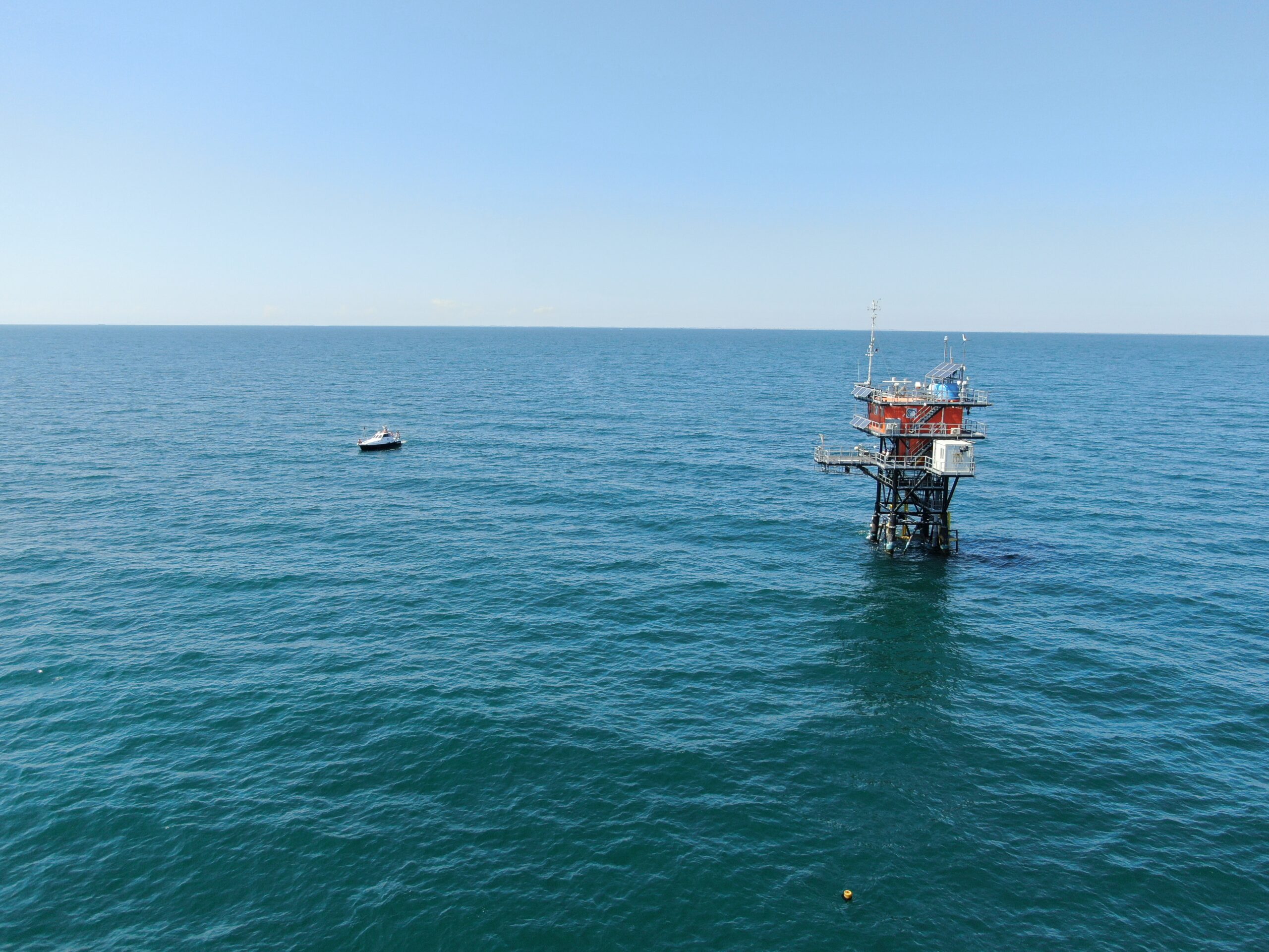
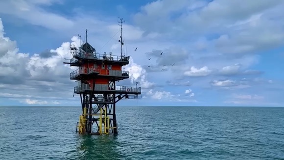
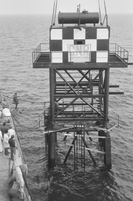
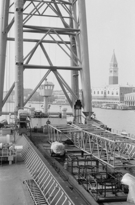
The Acqua Alta Oceanographic Tower, installed in March 1970 following the disastrous high water that struck Venice on November 4, 1966, is one of the main research facilities operated by the National Research Council.
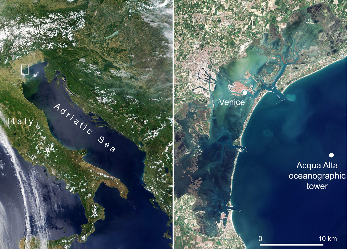
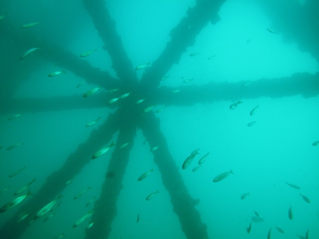
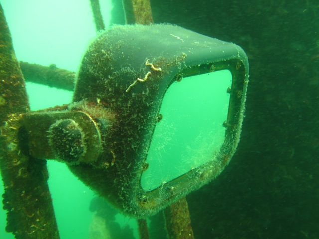
Installed about 8 miles off the coast of Venice, in a stretch of sea having a depth of about 16 m (GPS 45.3142467 N, 12.5082483 E), it consists of a laboratory module and accommodations, as well as sophisticated distribution facilities. management and real-time data transfer from numerous measurement stations and sensors installed.
The Acqua Alta Oceanographic Tower is also an important fixed point for periodic acquisition of water column samples and analysis of biological and chemical parameters.
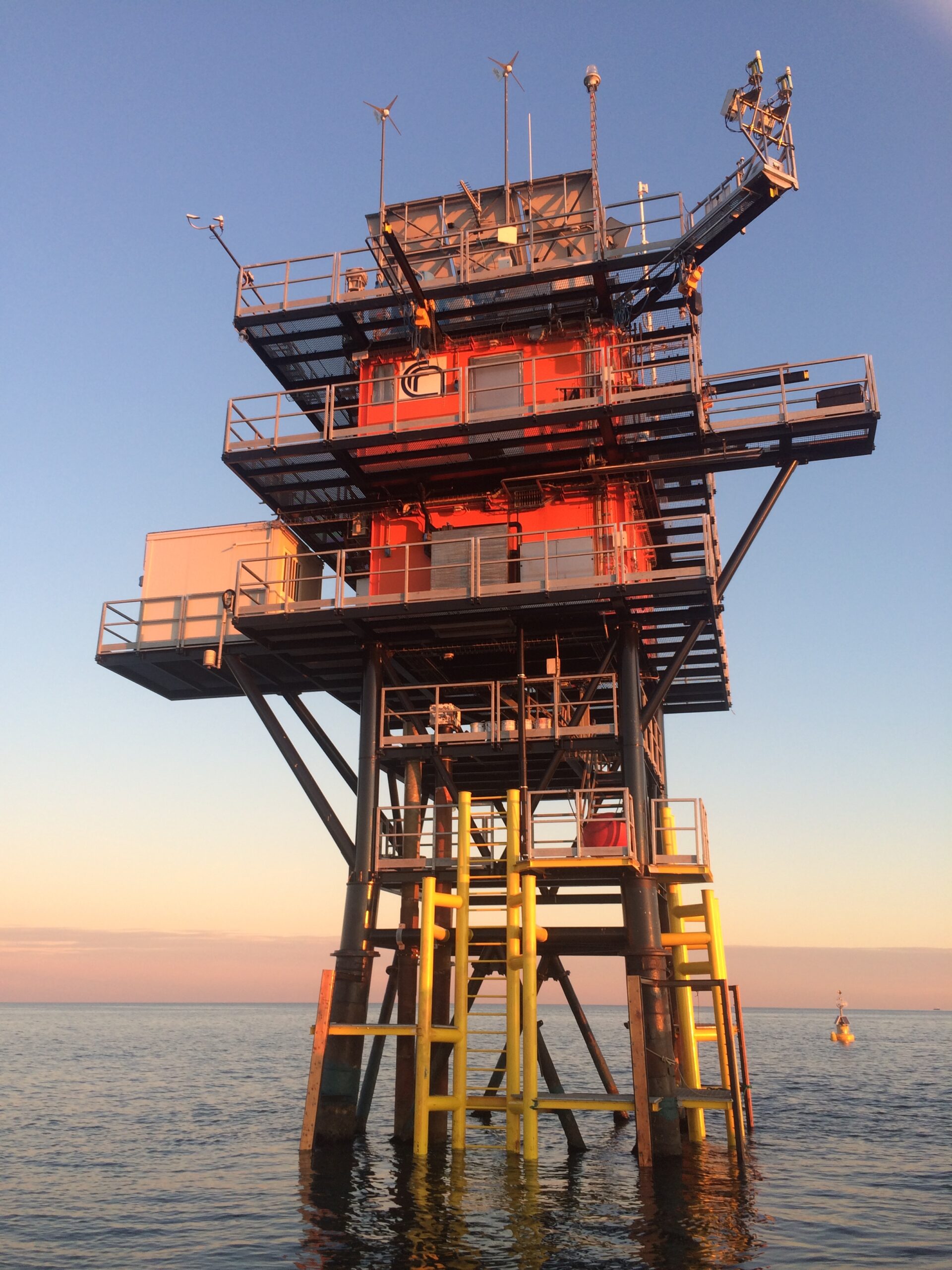
The structure and scientific equipment of the platform have been progressively developed and updated in order to ensure an ever greater and better use of the infrastructure also by the numerous external, research or institutional bodies with which the CNR collaborates.
Equipped with the latest technology, it is among the very few existing fixed facilities in the world that are operational for scientific research in the open sea, allowing researchers and technicians to remain on board for extended periods during measurement campaigns and in all weather and sea conditions.
The permanent instrumentation includes complete meteorological and oceanographic stations whose data are both recorded on board and transmitted in real time to shore. Tide and wind data measured offshore are essential information for the correct operational forecasting of high water in Venice. The historical series of directional wave measurements, uninterrupted since 1979, represents one of the longest historical series available in the world. Its length, which now exceeds 40 years, makes it an extremely important study tool for understanding the processes taking place as a result of climate change. As the only permanent and mannable point at sea, it has provided sea truth for the calibration of instruments installed on artificial satellites such as the ERS-1 altimeter and the optical properties of the sea measured by SeaWiFS and OLTS. Wave measurement campaigns with on-board personnel and highly sophisticated instrumentation have helped to clarify unknown aspects of the dynamics of wave generation by the wind. This has led to a marked improvement in operational sea forecasting worldwide. Campaigns carried out on board include physical, chemical, and biological activities. The facility and its instrumentation, activities, research campaigns, measurements, and results obtained have enabled the National Research Council to produce numerous scientific publications and international patents.
Growing progressively over some 40 years of activity, in June 2016 the National Research Council initiated a major renovation to enable the continued operation of this important facility, a reference point for research involving marine science and oceanography, water health monitoring, and meteorology.
The complex operation has allowed the complete renovation of the upper part of the structure and the reinforcement of the supporting substructures, as well as the rationalization and enhancement of the technological systems supporting scientific activity, offering additional opportunities to all those already affected by the acquisition of data and measurements made by the platform, confirming the commitment of scientific research to the preservation of Venice and more generally of the marine environment.
The opportunity of the renovation of this important infrastructure at sea has allowed the restoration of the instrumentation and sensors necessary first and foremost for the maintenance of the long historical data series (e.g. Pomaro et al., 2018) and collaborations with entities such as the Tidal Forecasting and Reporting Center of the Municipality of Venice and the Joint Research Centre of the European Commission, and the planning of an upcoming increase in instrumental equipment.
The measurements acquired continuously by this infrastructure include some of the essential oceanic variables identified by the United Nations, a complete list of which is given below, highlighting in bold the measurements acquired at the Acqua Alta Oceanographic Tower in operational mode. Instead, those being implemented or planned in the near future are highlighted in bold italics, with the aim of contributing at the level of the most important international infrastructures to knowledge of the state of the oceans.
The availability of a fixed offshore infrastructure is not only relevant for the acquisition of measurements on an operational basis but also for the planning of experimental measurement campaigns for the study of meteo-oceanographic processes (physical, biogeochemical, etc.), by the international scientific community. This has also enabled the detailed study of events such as Storm Vaia of October 29, 2018 or the exceptional high water event of November 12, 2019.
For the past few years, webcams that can be accessed through the Institute of Marine Sciences website (www.ismar.cnr.it) and through the ISMAR Data smartphone application have also been installed on the platform.
The latter, in particular, in addition to providing access to real-time data by allowing users to view measurement trends related to the main meteorological, oceanographic and hydrological variables, through the “Analyze” function allows users to view the historical archive of measurement data collected for each of the available stations by defining time interval and variables of interest, thus allowing them to delve into aspects such as characteristic values, daily and stationary cycle and mutual interdependence.
The platform has enabled CNR-ISMAR researchers to develop two patents for observing the sea by applying stereo-photogrammetric techniques that combine computer vision and oceanography to estimate sea movements even from moving cameras.
The High Water Oceanographic Platform contributes to the European research infrastructures DANUBIUS-ESFRI, and JERICO-RI, LTER, EMBRC, as well as the NASA Aeronet monitoring network.
Essential Climate and Oceanic Variables (ECVs and EOVs) | |||
Variable | Operational Measurements Start | Measurement interval | Institution |
Atmosphere | |||
2008 | 5 min | CNR-ISMAR / CPSM / ISPRA | |
2008 | 5 min | CNR-ISMAR / CPSM / ISPRA | |
2008 | 5 min | CNR-ISMAR / CPSM / ISPRA | |
2008 | 5 min | CNR-ISMAR / CPSM / ISPRA | |
2008 | 5 min | CNR-ISMAR / CPSM / ISPRA | |
1982 | 5 min | CNR-ISMAR / CPSM / ISPRA | |
Ocean | |||
– | – | ||
1983 | 5 min | CNR-ISMAR / CPSM | |
1979 | 15 min | CNR-ISMAR / CPSM | |
2008 | 30 min | CNR-ISMAR | |
2009 | 10 min | CNR-ISMAR | |
– | – | ||
2009 | 10 min | CNR-ISMAR | |
2008 | 30 min | CNR-ISMAR | |
2009 | 10 min | CNR-ISMAR | |
2009 | 10 min | CNR-ISMAR | |
– | – | ||
– | – | ||
2009 | monthly | CNR-ISMAR | |
2002 | 5 min | JRC-EU / CNR-ISMAR | |
2009 | monthly | CNR-ISMAR | |
– | – | ||
– | – | ||
– | – | ||
– | – | ||
– | – | ||
2009 | monthly | CNR-ISMAR | |
2012 | monthly | CNR-ISMAR | |
– | – | ||
– | – | ||
Microbe biomass and diversity (*emerging) | – | – | |
Invertebrate abundance and distribution (*emerging) | – | – | |
2019 | continuous | CNR-ISMAR | |
Pubblications:
Cavaleri, L., M. Bajo, F. Barbariol, M. Bastianini, A. Benetazzo, L. Bertotti, J. Chiggiato, C. Ferrarin, F. Trincardi, and G. Umgiesser (2020), The 2019 flooding of Venice and its implications for future predictions, Oceanography, 33(1), 42–49, https://doi.org/10.5670/oceanog.2020.105
Cavaleri, L., M. Bajo, F. Barbariol, M. Bastianini, A. Benetazzo, L. Bertotti, J. Chiggiato, S. Davolio, C. Ferrarin, L. Magnusson, A. Papa, P. Pezzutto, A. Pomaro, and G. Umgiesser (2019), The October 29, 2018 storm in Northern Italy – an exceptional event and its modeling, Prog. Oceanogr., 178, 102,178, https://doi.org/10.1016/j.pocean.2019.102178
Pomaro, A., Cavaleri, L., Lionello, P., 2018. 39 years of directional wave recorded data and relative problems, climatological implications and use. Sci. Data 5, 180139. https://doi.org/10.1038/sdata.2018.139.
Piazzola, J; Mihalopoulos, N; Canepa, E; Tedeschi, G; Prati, P; Zarmpas, P; Bastianini, M; Missamou, T; Cavaleri, L. Characterization of aerosols above the Northern Adriatic Sea: Case studies of offshore and onshore wind conditions,Atmospheric Environment,132,,153-162,2016
Benetazzo, A., Bergamasco, A., Bonaldo, D., Falcieri, F.M., Sclavo, M., Langone, L., Carniel, S., 2014. Response of the Adriatic Sea to an intense cold air outbreak: Dense water dynamics and wave-induced transport. PROGRESS IN OCEANOGRAPHY 128, 115-138.
Benetazzo A., Barbariol F., Bergamasco F., Torsello A., Carniel S., Sclavo M., 2015. Observation of extreme sea waves in a space-time ensemble. JOURNAL OF PHYSICAL OCEANOGRAPHY 45, 2261–2275.
Benetazzo, A.; Fedele, F.; Gallego, G.; Shih, P.C.; Yezzi, A. Offshore stereo measurements of gravity waves. Coast. Eng. 2012, 64, 127–138.
Bastianini, M; Cavaleri, L; La Rocca, T; An extreme meteorological event at the ISMAR oceanographic tower. Natural Hazards and Earth System Sciences,12,2,281,2012,Copernicus GmbH
Cavaleri, L. The oceanographic tower Acqua Alta—Activity and prediction of sea states at Venice. Coast. Eng. 2000, 39, 29–70.
OpenData:
Pomaro, A., L. Cavaleri, A.Papa, P. Lionello, 2018. 39 years of directional wave recorded data at the Acqua Alta oceanographic tower. PANGAEA. https://doi.org/10.1594/PANGAEA.885361